HOUSTON – Heavy rainfall will continue to be a possibility across the Houston area as we’re watching Potential Tropical Cyclone One in the Gulf.
Read more 15-year-old dead after walking into retention pond in Montgomery County, officials say
FLOODING CONCERNS REMAIN HIGH
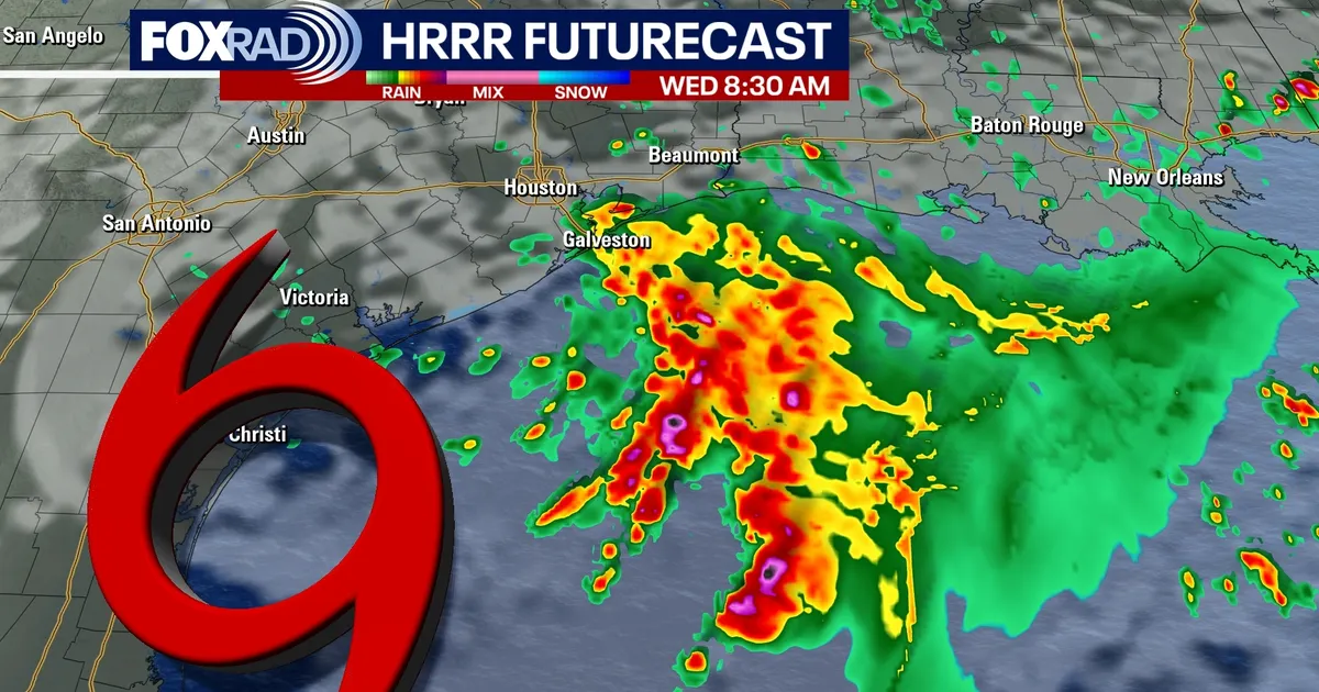
FOX 26 Storm Alert continues through Wednesday with a Flood Watch continuing across Southeast Texas. Periods of heavy showers and storms could still lead to quick street flooding, especially in low-lying areas and spots that have already picked up heavy rain.
GULF DISTURBANCE NAMED P.T.C. #1
An area of low pressure near S. Texas will push into the NW Gulf soon. It has been named Potential Tropical Cyclone One and is forecast to become Tropical Storm Arthur by Wednesday. It should brush past Houston and Galveston on Wednesday bringing the threat for some heavy bands of rain, gusty winds and a few strong storms. But the worst of the heavy rain may end up staying just offshore. You still want to be alert for flooding as there could still be some flooded spots across Southeast Texas, especially near the coast.
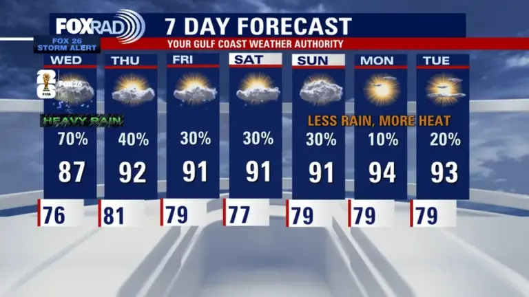
SUMMER HEAT STARTS TO RETURN
Rain chances should gradually drop late week as the pattern becomes more typical for June. That means hotter and more humid weather returns, with highs climbing back near 90 and only scattered showers or storms possible by the weekend.
Read more Houston weather: Storm Alert, Flood Watch continues Tuesday