
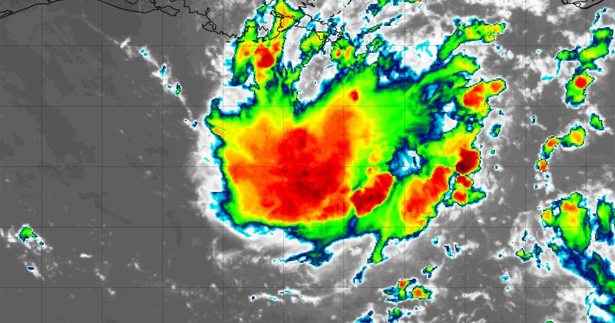
HOUSTON – Two tropical disturbances are being tracked in the Atlantic Ocean this week, and one of them is in the Gulf of America.
Read more North Carolina warns mobile petting zoo visitors of rabies exposure after baby goats test positive
According to the National Hurricane Center, both disturbances have a low chance of development.
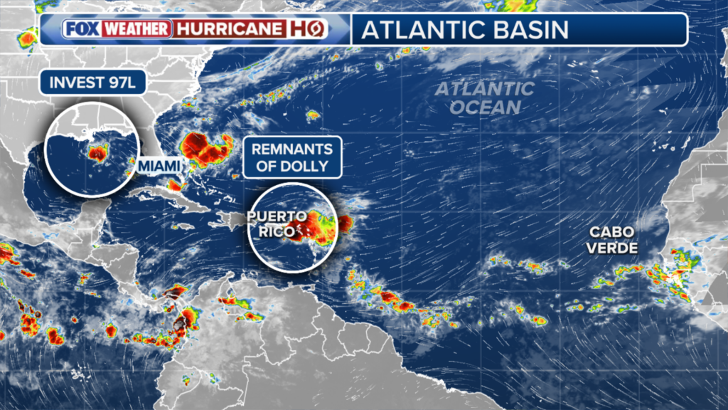
(FOX Weather)
The disturbance in the Gulf, which has been designated Invest 97L, is located off the coast of Louisiana, but the development zone does include parts of the Texas coast.
An “invest” is a term used by the NHC to indicate an area under increased monitoring for potential development.
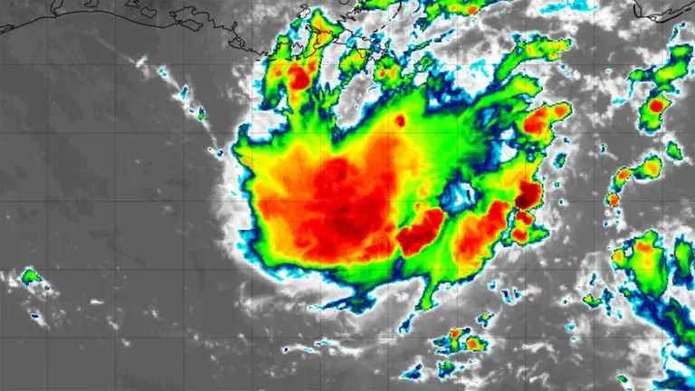
Invest 97L is seen on Aug. 30, 2026. (NOAA / FOX Local)
Regardless of development, this one could bring heavy rain to the Houston area this week as it moves inland.
Read more Chicago mass shooting leaves 1 dead, 9 others injured on South Side, CPD says
The other disturbance, which is the remnants of Tropical Storm Dolly that formed last week, could develop as it moves toward the Bahamas this week, and bring periods of heavy rain to the Florida Peninsula.
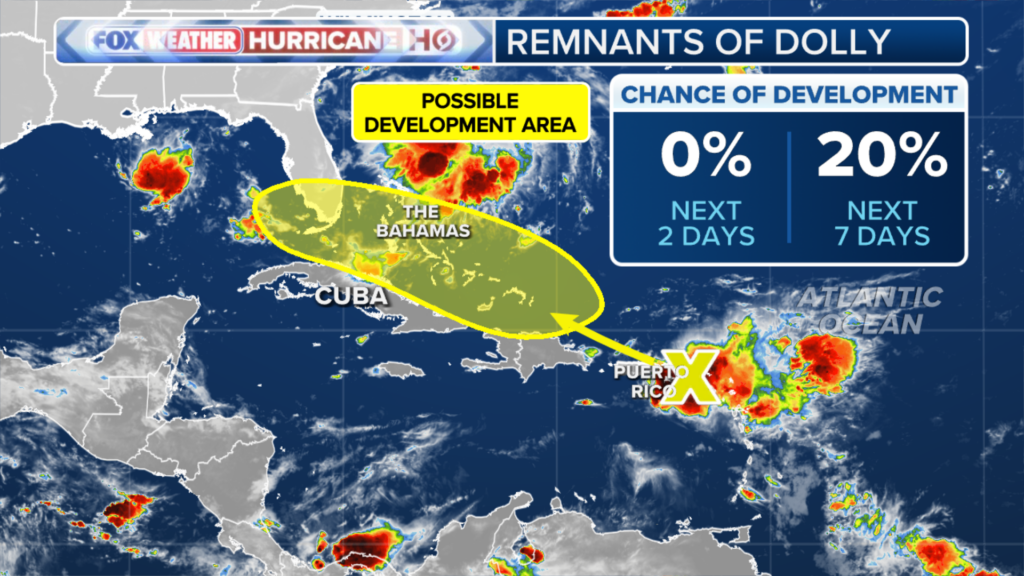
(FOX Weather)
Peak of hurricane season approaching
If either of these disturbances become a tropical storm, they would take the next names on the 2026 list – Edouard and Fay.
An uptick in activity in the Atlantic basin in expected this time of year. Most tropical activity that occurs in a given year happens from August to October, with Sept. 10 being the statistical peak.
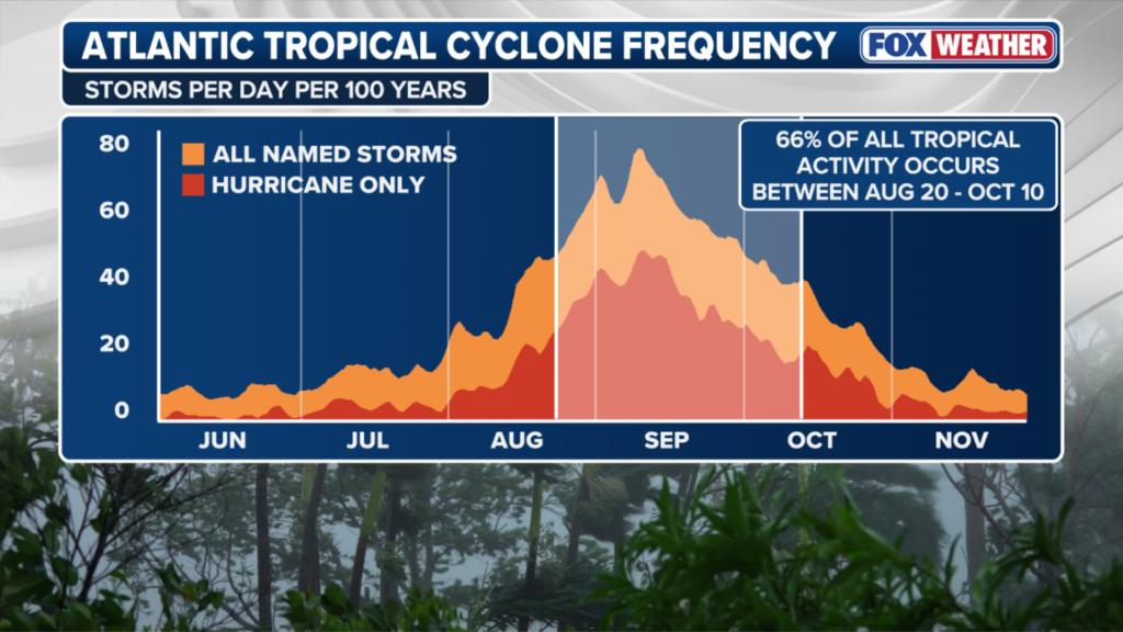
(FOX Weather)
Now is a good time to review your hurricane safety plan and make sure you have enough supplies to be on your own for three days if a tropical system hits.
Read more Walmart re-announces recall on 165K dressers – because more were sold