COLD FRONT GETTING CLOSER
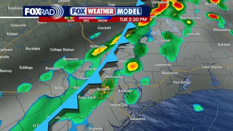
HOUSTON – Isolated showers are possible Monday night across SE Texas. But the main event will be what’s happening to our northwest with our Election Day cold front rolling over places like Dallas, Waco and Austin. This front is bringing the threat for severe storms and heavy rain to our northwest overnight.
Read more Baytown shooting behind bar leaves man hospitalized; suspect charged
STORMS COULD AFFECT VOTING PLANS
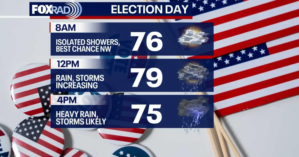
Showers and thunderstorms are expected Tuesday, Election Day, as a cold front moves through the Houston area. Some storms could bring brief, heavy rain, strong winds and lightning with the highest chance from late morning through late afternoon. There’s even a low 2% tornado risk for northeast locations like Livingston. Check Fox Local before heading out to vote.
Read more Dallas Cowboys fall to 3-5 after overtime collapse against Arizona Cardinals
A PLEASANT CHANGE FOLLOWS
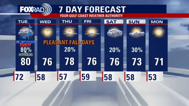
Cooler, drier air arrives behind the front Tuesday night, bringing pleasant weather Wednesday and Thursday with mostly clear skies, brisk nights and comfortable days. Most areas in and around Houston will enjoy highs in the 70s these days and morning lows in the 50s. Let’s welcome back that fall chill!
Read more Health insurance open enrollment: 5 things to review before choosing a plan