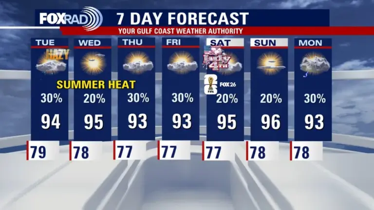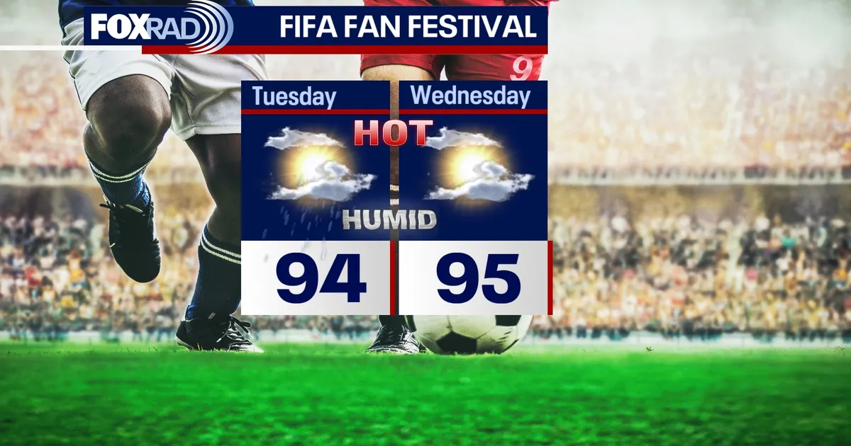
HOUSTON – Expect dusty skies as the summer heat continues into Tuesday across the Houston area.
Read more Texas City homeowner says roof began leaking after solar panel installation; company responds
DUSTY SKIES MEET SUMMER HEAT
Saharan dust will continue to bring hazy skies to Southeast Texas Monday night & Tuesday while temperatures climb into the 90s during the afternoon. Expect heat index values above 100 during the afternoon. The dust could also have a slight impact on air quality, especially for people sensitive to dust or pollution.
RAIN CHANCES START TO CREEP BACK
A slight chance for showers and storms begins Tuesday as a little more moisture returns. Most areas will still stay dry, but a few isolated downpours could pop up during the hotter parts of the day.
Read more Two confirmed human cases of West Nile virus in the Houston area
HOLIDAY FORECAST LOOKS MOSTLY STEAMY
The Fourth of July forecast still looks hot and humid with only a slight chance for storms. Any rain should be spotty, but a few brief downpours or lightning delays will be possible around outdoor holiday plans.