HOUSTON – A large plume of dust from the Sahara Desert is forecast to hit Texas last this weekend or early next week.
Read more Wendy’s stock surged so much that trading was halted multiple times
What we know:
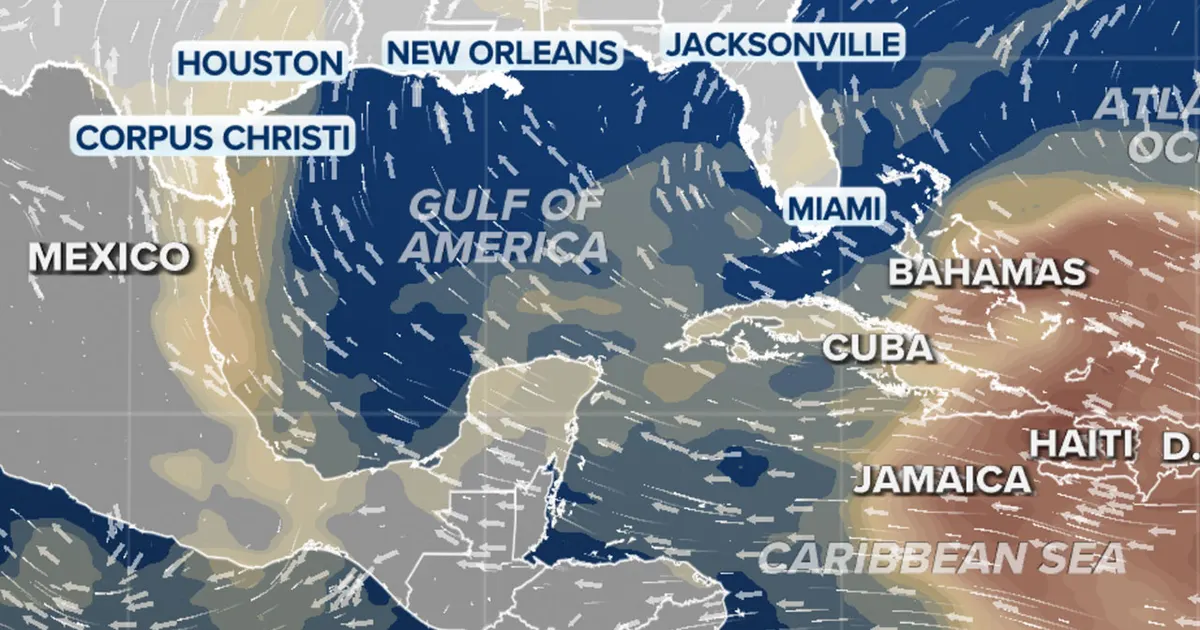
Computer forecast models show the batch of dust from Africa will move out of the Caribbean Sea and into the Gulf of America over the weekend. It is expected to arrive in Texas late Sunday or early Monday.
The forecast calls for the plume to move across Texas during the week, before dissipating by July 2.
Big picture view:
June is generally the most common time of the year for Saharan dust in Texas. That’s usually when high heat in the desert lifts tons of dust into the atmosphere. Air currents carry the dirt particles across the Atlantic and deposit them in the Western Hemisphere.
When dust is present, skies take on a hazy, milky look during the day. It can also create vivid sunrises and sunsets, as well as impact air quality.
Read more Florida man accused of kidnapping teen, hiding her in dryer
If rain falls through the dust, it can create so-called “blood rain” – a dirty mess left behind on cars and other surfaces after the raindrops evaporate.
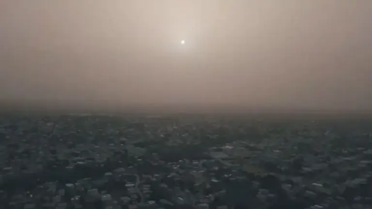
A massive cloud of Sahara dust is blanketing the Caribbean as it heads to the U.S. with a size and concentration that experts say hasn’t been seen in half a century.(Credit: Alexander James via Storyful)
Dig deeper:
One plus of Saharan dust is that the air carrying it is extremely dry, which helps quash the development of tropical systems.
The dust also provides essential nutrients to plant life in the Western Hemisphere.
Read more New power plant to bring more energy to West Texas