HOUSTON – Flooded roadways should be expected as large amounts of rainfall move across the Houston area over the next several days.
Read more B-52 crashes after takeoff at Edwards Air Force Base
FLOODING CONCERNS TAKE PRIORITY
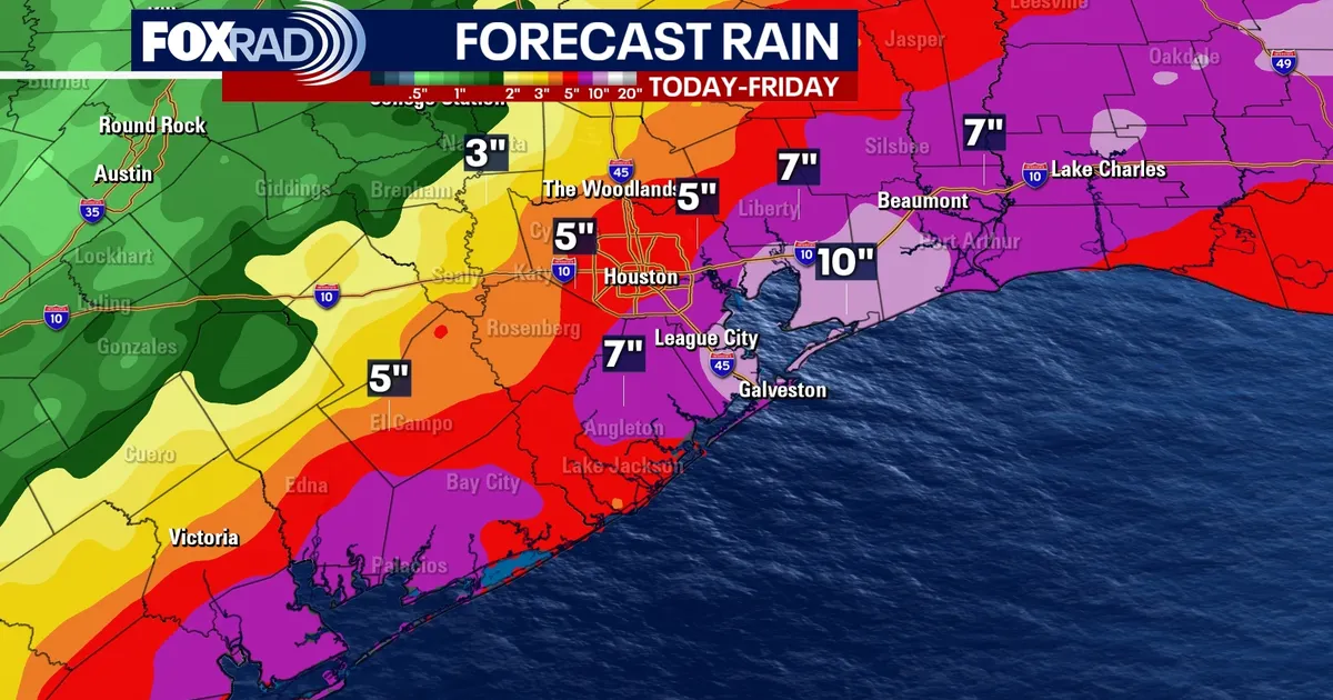
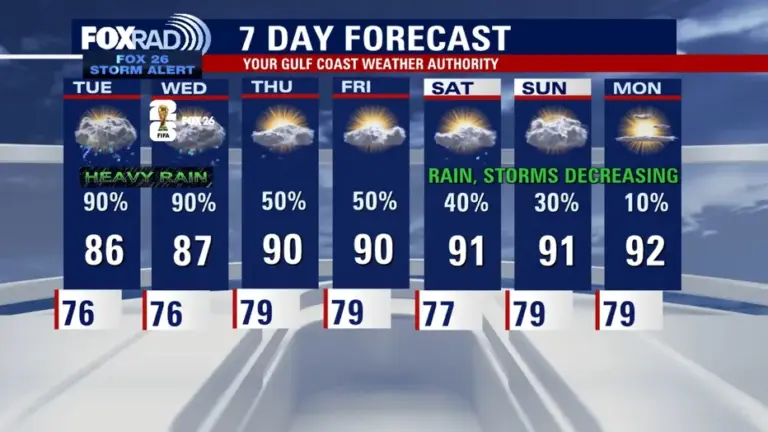
Monday is a FOX 26 Storm Alert Day with a Flood Watch in effect for Southeast Texas. Multiple rounds of showers and storms could produce heavy rain in a short amount of time, leading to quick street flooding, especially in low-lying and poor-drainage areas. This flood watch has now been extended for all of Southeast Texas through 7 AM Thursday with multiple rounds of extremely heavy rain and strong storms expected.
MORE DOWNPOURS BEFORE THE PATTERN EASES
The heavy rain threat continues today through Wednesday as tropical moisture and a stalled front stay locked in over the region. Rain totals will vary, but spots that see repeated storms could pick up several inches of rain and deal with rising water on roads, bayous, and creeks.
Read more Newsom says Trump ordered DOJ to put him on ‘hit list’
TROPICAL DISTURBANCE UPGRADED TO MEDIUM CHANCE FOR DEVELOPMENT
A weak tropical system has a MEDIUM chance to develop near the Texas Gulf Coast in the NW Gulf. The chance is now 40% over the next two days, and up to 50% over the next seven days. Heavy rain remains the main concern for Southeast Texas. Even without a named system, deep tropical moisture will keep the flood risk higher over the next couple of days. If a tropical system would develop the name would be Authur. Keep checking back for updates, as we are in for some very unsettled weather the next few days!
Read more Trump says July 4th American 250 celebration will be a ‘TRUMP RALLY’