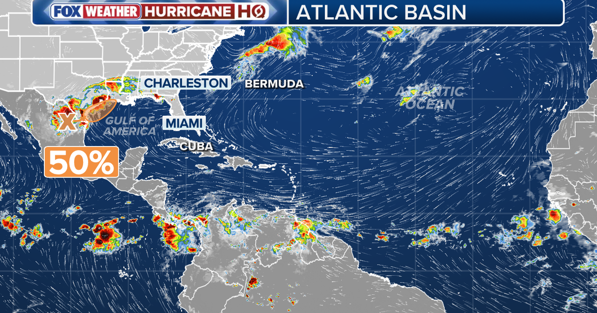
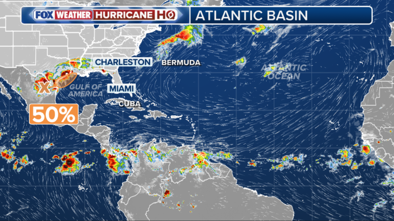
HOUSTON – There is a weather disturbance over northeastern Mexico that carries a 50% chance of developing into a tropical cyclone over the next week, according to an update from the National Hurricane Center on Monday.
Read more Judge dismisses lawsuit by Yosemite ranger fired over transgender flag
Tropical disturbance
As of 1 p.m., the trough of low pressure was producing a large, disorganized area of showers and thunderstorms. While development is not anticipated over the next day or so while the system remains inland, meteorologists warned it could re-emerge over the northwestern Gulf late Tuesday or Wednesday.
Once over water, environmental conditions are expected to be marginally conducive for the system to briefly strengthen into a short-lived tropical storm between Wednesday and Thursday. The National Hurricane Center puts the chances of cyclone formation at 40% over the next 48 hours and 50% over the next seven days.
Watches and warnings expected
Tropical Storm Watches or Warnings may be required as early as Tuesday.
Regardless of whether the system officially develops into a tropical cyclone, officials urged residents and interests across southern and eastern Texas, as well as portions of Louisiana and Mississippi, to prepare for heavy weather. The system is expected to bring periods of intense rainfall over the next several days, which could trigger widespread, life-threatening flash, urban, and river flooding.
Read more Anne Schedeen, actress who played mom on ‘ALF,’ dies at 77
Featured
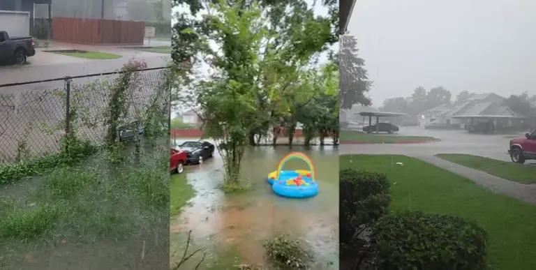

Gallery: Photos, videos of Houston street flooding, rain amid Flood Watch
Heavy rain is falling across Houston on Monday as Southeast Texas remains under a Flood Watch through Thursday. See a gallery of photos and videos.
Gusty winds and coastal flooding are also possible along parts of the northwestern Gulf Coast.
Read more Gallery: Photos, videos of Houston street flooding, rain amid Flood Watch