HOUSTON – More storms and rainfall will be possible for Wednesday across the Houston area.
Houston weather: Storms possible again on Wednesday
STEAMY WEATHER & STORMS SETTLE IN
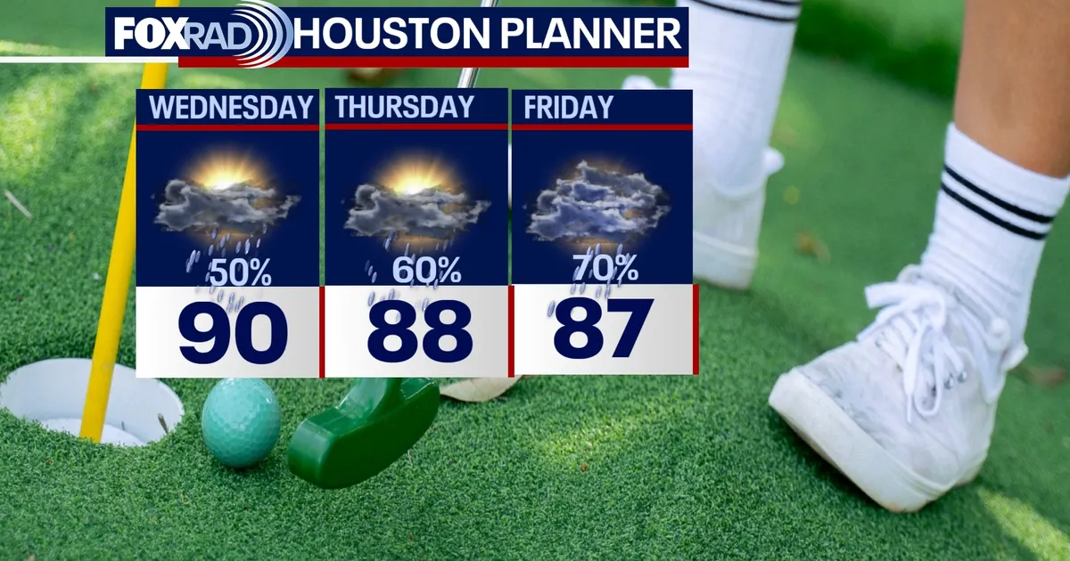
Expect a hot and humid week across the Houston area with highs in the upper 80s to low 90s. Please take it easy in the heat and drink plenty of water. Tropical moisture with the front dropping in from the north produced scattered strong to severe storms this afternoon and evening. There were several reports of quarter sized hail around Cypress and Jersey Village. More scattered showers & storms will be possible, with steamy conditions in between the rain.
A WETTER PATTERN DEVELOPS
Storm chances are on the increase the next few days and big rain chances last through at least Saturday as a weak front blends with tropical moisture over Southeast Texas. Scattered showers and storms become more common through the week, and some could be heavy at times. Biggest chance for widespread rain will be Friday and Saturday. Keep the rain gear close by as many areas will pick up an additional 1-3″ of rain by the end of the week.
Read more Jane Nelson, Texas’ top election official, stepping down as Secretary of State
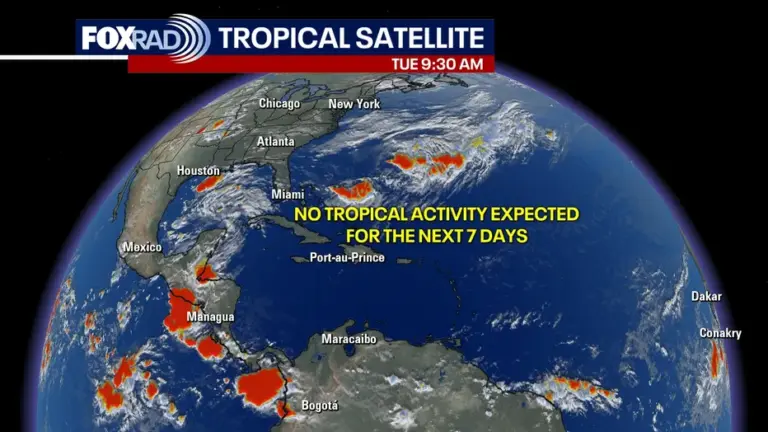
NEW HURRICANE SEASON IN THE ATLANTIC BASIN
There are no immediate tropical concerns for Houston, but tropical moisture could lead to downpours locally later this week. A few models try to develop a weak disturbance in the Gulf by Thursday and Friday. But at this time it does not appear that it will take on any tropical characteristics. However, it will likely spread additional tropical moisture our way enhancing our rain chances late in the week. Visit Fox26Houston.com/tropics for more information and to check out our daily tropical updates.
Read more Rio Grande compact between Texas, New Mexico, Colorado approved by Supreme Court