HOUSTON – Tuesday will look and feel a lot like a Monday for many because of the Memorial Day holiday.
Read more Volunteer wildlife rehabilitators say proposed Texas changes could mean fewer lives saved
The weather also stays the same, very warm across Southeast Texas with highs in the upper 80s to near 90.
Most areas will remain dry for much of the day, but isolated afternoon and evening thunderstorms could still develop.
Wetter pattern mid-week
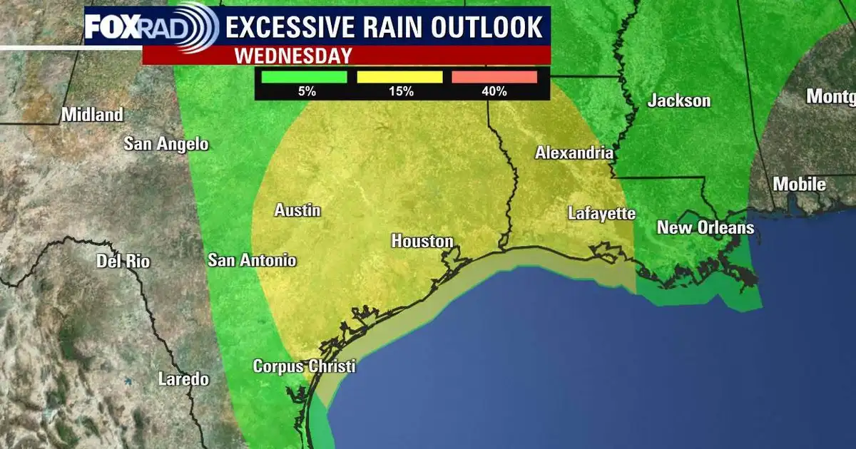
Storm coverage ramps back up by Wednesday into Thursday as another disturbance moves into the region.
This next round is expected to bring more widespread showers and thunderstorms with rain totals for most folks at 1 to 2 inches, but isolated areas could see 3 to 5 inches of rainfall.
Read more Teen hospitalized in Galveston after offshore shark bite
Locally heavy rain and gusty storms possible
Some of the mid-week storms could produce torrential rainfall, gusty winds, and frequent lightning. While widespread severe weather is not expected at this time, localized flooding and pockets of heavy rain are concerns from Wednesday morning through Thursday morning.
Weekend starts warm
The midweek rain will come to an end by Friday, and Houston will see a change to a warmer and drier pattern.
Those lower rain chances and higher temperatures will cling around for Saturday as well.
There are still some questions for the end of the weekend with another storm system possible to move into the area.
Read more 11 rescued after boat catches fire near Texas City Dike