
HOUSTON – A flood watch remains in effect for all coastal counties in Southeast Texas through Monday evening, even as a soggy holiday weekend sees a brief reprieve before heavier storms return later in the week.
Read more Gunshots reported near White House
Flood threat continues
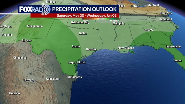
The National Weather Service has extended the flood watch until 7 p.m. Monday, warning that an additional 1 to 2 inches of rain is possible through the Memorial Day holiday.
The storm system follows a tumultuous Saturday across Southeast Texas, which was battered by several rounds of heavy rain and frequent lightning.
Outdoor planning
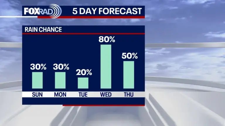
However, conditions are expected to improve for outdoor holiday plans on Sunday and Monday. Rain chances have dropped to 30% to 40%, with only isolated showers and thunderstorms during the afternoon and evening hours. The remainder of the holiday weekend will be characterized by partly cloudy skies alongside warm and humid conditions.
Read more Active shooter reported in New Caney area; ‘multiple’ people shot
Rain in the forecast
The break in the weather will be short-lived, as we track the next round of heavy rain and thunderstorm development expected to hit Southeast Texas mid-week.
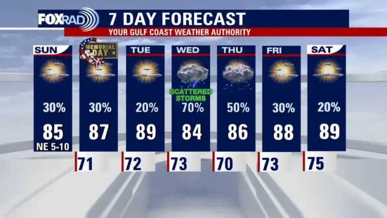
A plume of moisture is forecast to move east across the state late Tuesday night into Wednesday, bringing an increase in shower coverage from Wednesday morning through the afternoon.
We will have a better understanding of the timing and intensity of the mid-week storms as the system approaches.
Read more Walmart warns shoppers could face higher prices as fuel costs surge, tax refunds dry up