
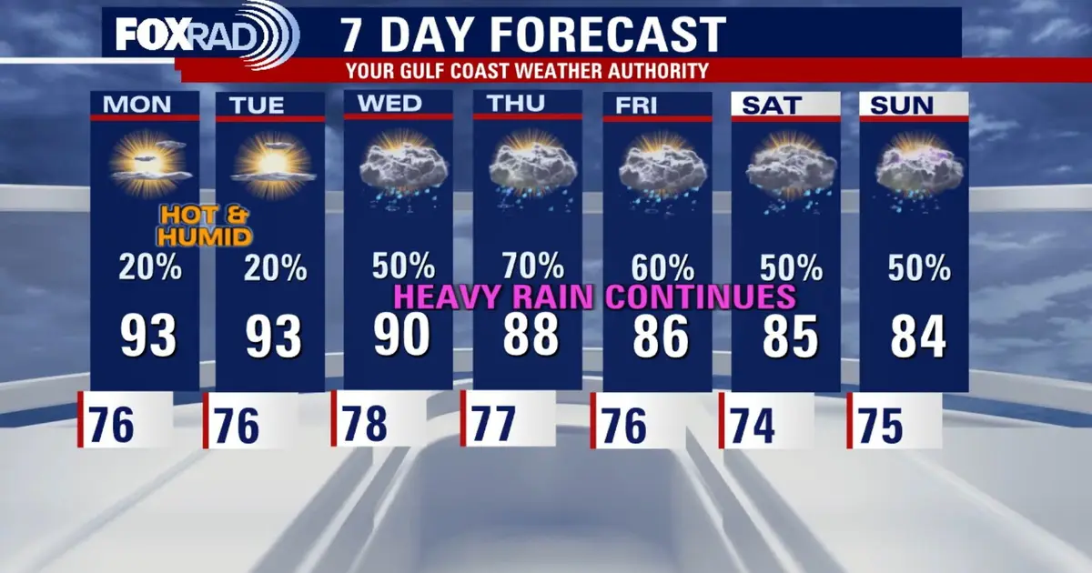
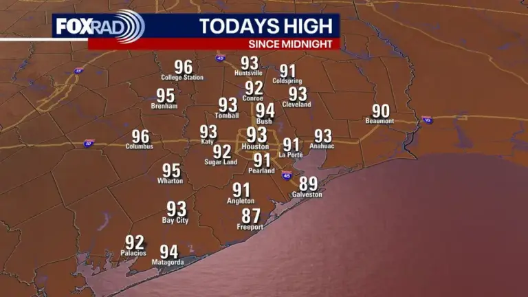
HOUSTON – Humidity increases starting Sunday, so as we move into the beginning of the week we can expect to see some areas continue in the low to middle 90s. As rain chances increase midweek though, temperatures will begin to drop back to seasonal norms.
Read more Astros win AL West with 81-81 record, worst for first-place team, beat A’s 9-0
Stormy next week
Storm chances increase next week due to a slow moving front mixed with tropical moisture from the pacific. This wetter, stormier weather will help hold temperatures down in the low to mid 80s.
This is a complex weather setup and global forecast models are still not in agreement on timing of the rain.
This front will likely pull in leftover moisture from what is now Hurricane Polo in the Pacific.
Read more Tunnel to Towers 5K Run & Walk takes place in NYC for 25th year
Right now, rain chances appear to increase on Wednesday with the heaviest rain Thursday and Friday. Some areas of Southeast Texas will be under a 2/4 risk for flooding on Thursday.
Monitoring the Atlantic
Tropical depression Fay continues to fizzle out.
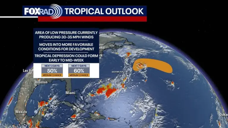
Now we are monitoring an area of disorganized showers and storms east of Bermuda that has a 50% chance of becoming a tropical depression by the middle of the week. This will likely move away from the U.S.
What about the Pacific?
There are two hurricanes and a new tropical storm in the Pacific.
Hurricane Polo is something Texans should be keeping an eye on. It will make landfall across Baja California early this week, and its remnants will move into New Mexico and Texas, bringing the potential for some heavy rain if not flooding.
Read more Nearly 333 pounds of tuna recalled over food poisoning risk